CAI Adventure Group

Are you interested in hiking, rock climbing, or caving?
Join our group! Have fun, while deepening your connection to our synagogue community.
If you have an interest in participating, suggestions for activities, or if you would like to lead excursions, please contact Gary Tenen at 520-403-7775 or email MLxana@aol.com
 Image: https://gemandmineralmuseum.arizona.edu/
University of Arizona Alfie Norville Gem & Mineral Museum
115 N. Church Ave. Suite 121, Tucson, AZ 85701
(the old Pima County Courthouse)
Wednesday, April 23, 2025 • 10:00am
We will meet at 10 am on Wednesday, April 23rd, 2025, to visit Tucson’s hidden gem (pun intended), the Alfie Norville Gem & Mineral Museum. (https://uamineralmuseum.com). Far more than just a few pretty rocks, this museum rivals anything you might find at the Smithsonian! The museum includes minerals and gems native to Arizona, emphasizing the state's rich geological heritage, a stunning collection of cut gemstones & jewelry, and a massive display showing the development and diversity of minerals over geological time from all over the world. The museum offers interactive exhibits and touchable specimens, providing an immersive educational experience!
Approximate time at the museum is 2+ hours.
GROUP SIZE IS LIMITED TO 12. ENTRY COST TO THE GEM MUSEUM IS COVERED.
Optional, after the museum visit, is a light lunch, possibly at the Coronet Café (not kosher) or Café a la C’Art (not kosher) at the Tucson Museum of Art. After lunch, optional art gallery visits or a visit to the Tucson Museum of Art (admission not covered by CAI). Nearby galleries:
- Etherton Gallery specializes in vintage, classic, and contemporary photography, as well as regional art across various media
- Bahti Indian Arts has been a Tucson institution for over 70 years. No tacky souvenir stuff here. Bahti Indian Arts specializes in fine Native American art, including pottery, baskets, textiles, and jewelry. The gallery showcases exquisite works in silver and other materials from Hopi, Tewa, Zuni, and Navajo artists, offering authentic pieces that reflect the rich cultural heritage of the Southwest.
Meet-up information
We will meet at 10 am at the Gem Museum
115 N. Church Ave. Suite 121, Tucson, AZ 85701
(the old Pima County Courthouse)
Underground parking is available at a modest cost. Generally, we should be able to park for free after visiting the museum and getting our tickets validated at the Pima County Visitor center. This is an Attend at Your Own Risk event.
By RSVPing "yes" to this event you are agreeing not to hold the organizer or CAI liable for any injury, death, or property loss or damage during the hike, as well as in transit to and from the event. RSVP by April 17th.
Contact the trip leader to RSVP or for more information:
Gary Tenen • 520-403-7775 • MLxana@aol.com
Mint Spring Trail Hike
Wednesday, June 18, 2025 at 8:00am
Sunday, June 22, 2025 at 8:00am
Trail Overview
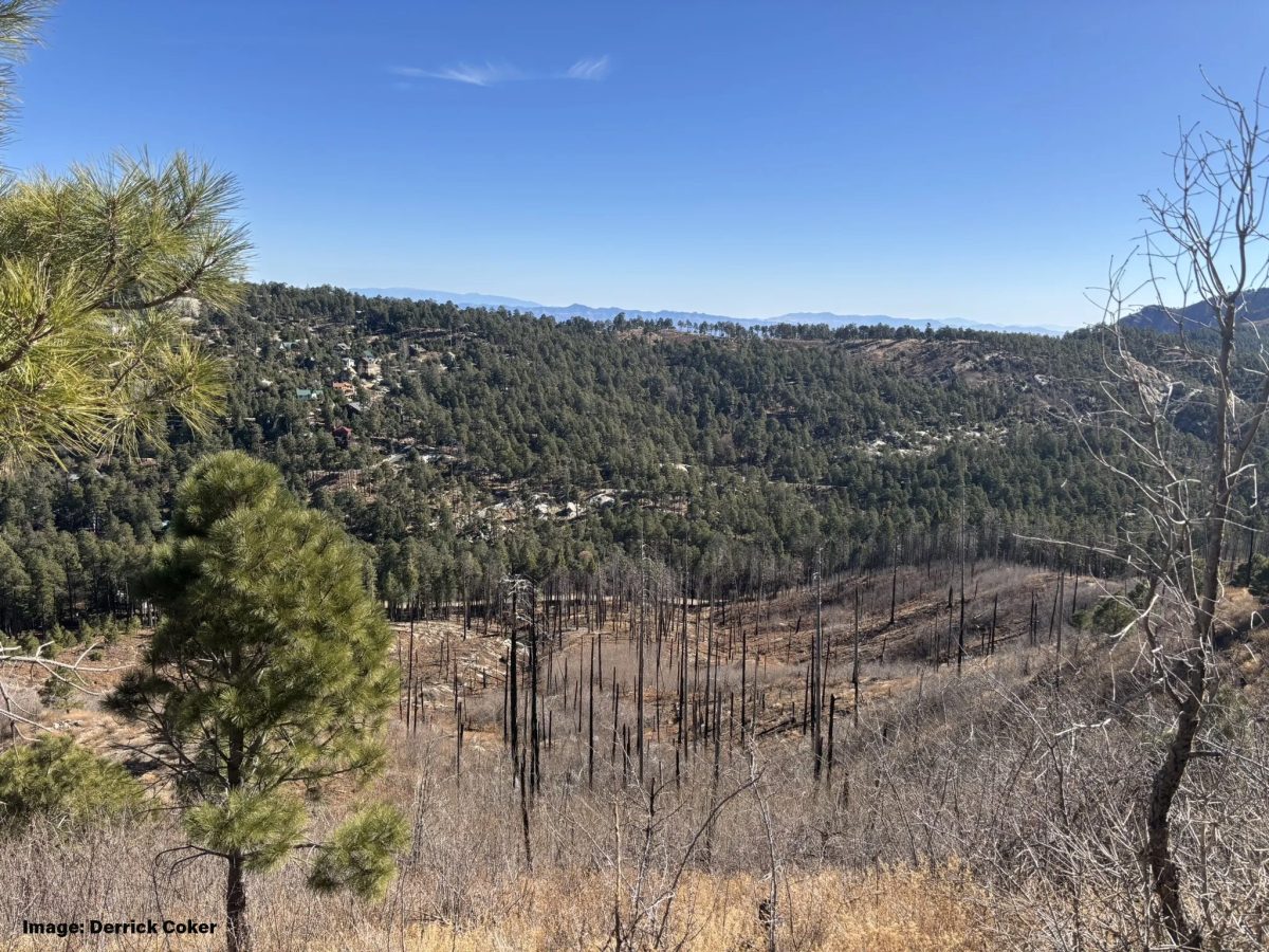
The 1.8-mile Mint Spring Trail starts at the end of Carter Canyon Road in Summerhaven on Mt. Lemmon, and it intersects the Marshall Gulch/Aspen Trail at its end. While not as pretty as the Aspen Trail, it is much less travelled, offering the possibility for a little tranquility and some up-close observation of the fire damage from both the Aspen and Bighorn fires. It is a rocky trail with some moderate steepness. Total accumulated elevation gain for the 3.6 mile round trip is ≈1000 feet, which provides a good workout without being overly strenuous.
Trail Route
Once we reach the intersection with Aspen and Marshall Gulch Trails, we have several options to finish or extend our hike:
- Take a ½ mile detour down Wilderness of Rocks Trail, to the “hole in the rock” viewpoint.
- Hike about .3 miles south on Aspen to the big rock overlook (requires a bit of low-grade rock scrambling), which provides a striking panoramic view to the west.
- Hike along Aspen for about 1.25 miles to Lunch Ledge. Also, a great view and a quiet place for a snack.
- For all (or none of) the options, we return the way we came, back on the Mint Spring Trail.
- OR, possibly pre-staging a car at Marshall Gulch and returning that way, and then drive back to Carter Canyon.
Trail Conditions
The Mint Spring Trail is well-maintained, with some rocky sections and uneven terrain. Hikers should be prepared for occasional steep inclines and descents. Proper hiking shoes are recommended to navigate the trail safely and comfortably.
Fitness Level Required
This trail is suitable for hikers with a moderate level of fitness. PLEASE NOTE THAT THE HIKE IS AT 8000 FEET, where the air is thinner, and the effort needed will be greater than for a lower elevation hike. Due to the trail's conditions and elevation changes, it is not recommended for beginners without previous hiking experience.
Group Size
Please note that this hike is limited to 12 participants. We will try to maintain an average pace of about 1.50-2.0 miles per hour, which is considered a moderate to fast pace. Please sign up only if you are in good hiking shape and can go at this pace for the entire hike. The duration of the hike will be about 4 hours, plus travel time.
Meet-up information
We will meet at 8:00 am at LeBuzz Bakery, 9121 E Tanque Verde Rd #125, Tucson AZ 85749.
This is a Hike at Your Own Risk event. By RSVPing "yes" to this hike you are agreeing not to hold the trip leader or CAI liable for any injury, death, or property loss or damage during the hike, as well as in transit to and from the trailhead.
Rain cancels.
Contact the trip leader to RSVP or for more information:
Gary Tenen • 520-403-7775 • MLxana@aol.com
“Lower” Butterfly Trail to pick wild raspberries
July 6th, 2025 at 9:00am
Route Overview
We will park cars at both the lower Butterfly/Bigelow Trailhead (across from the Palisades Ranger Station) AND the upper Butterfly Trailhead (across from Sunset Trailhead). Starting at the lower trailhead we will hike 0.60 miles up to the saddle (341 feet of elevation gain) and then down 0.30 miles (193 feet of elevation loss). It is along this .3 mile section that the SMALL, wild raspberries grow. They should be ripe and plentiful in late June and early July. We will pick and eat all we can along the trail. Unfortunately, a permit is needed to collect or harvest any plant material from the National Forest, so we won’t be boxing them up to take home. Experience has shown that they don’t travel well and turn to mush quickly. After having fun with the raspberries, we will hike back up the 0.30 miles to the saddle and take a lunch break. After our break at the saddle, we have two options. Those wishing to head back can return by backtracking down the well-marked .6-mile trail to their cars.
Those wanting a longer hike can head up 0.30 miles (235 feet of gain – short but steep) to the top of Mount Bigelow. From the top we hike 1 mile along the dirt Mount Bigelow Road to an unmarked shortcut trail. This trail is steep but all downhill (often we share this trail with mountain bikers) and terminates at the dirt Mount Bigelow Road at Bear Wallow. From there we follow the level trail under the Tunnel of Love and take the rather unknown but very nice trail that parallels the highway, back to the cars at the Upper Butterfly Trail parking lot.
Trail Conditions
All the trails on this hike are well-maintained and easy to follow, with some rocky sections and uneven terrain. Hikers should be prepared for occasional steep inclines and descents. Proper hiking shoes are recommended to navigate the trail safely and comfortably.
Fitness Level Required
The easy, short hike is suitable for all hikers (no experience needed) with a moderate level of fitness. PLEASE NOTE THAT THE HIKE IS AT 8500 FEET, where the air is thinner, and the effort needed will be greater than for a lower elevation hike. The longer hike is recommended for those with previous hiking experience.
Group Size, Meet-up Location
Please note that this hike is limited to 18 participants. RSVP required.We will meet at 9:00 am at LeBuzz Bakery, 9121 E Tanque Verde Rd #125, Tucson AZ 85749.
This is a Hike at Your Own Risk event. By RSVPing "yes" to this hike you are agreeing not to hold the trip leader or CAI liable for any injury, death, or property loss or damage during the hike, as well as in transit to and from the trailhead.
Rain cancels.
Contact the trip leader to RSVP or for more information:
Gary Tenen • 520-403-7775 • MLxana@aol.com


